HOME | THE PROJECT | SHIPWRECKS | DIVING | VIRTUAL TOURS
J.D. MARSHALL NATURE PRESERVE
Shipwrecks
| Shipwreck Identifying Factor | Description |
|---|---|
| Wreck Name | Car Ferry No. 2 |
| Vessel Type | Train Car Ferry |
| Date Built | 1895 |
| Where Built | West Bay, MI |
| Size | The ship measured 309.9 ft (94.5 m) in length by 44.2 ft (13.5 m) abeam with a draft of 12 ft (3.7 m) and weighed 1548 gross tons. |
| Usage | Transport train cars across Lake Michigan and was part of the Lake Michigan (Railroad) Car Ferry Transportation Company fleet. |
| Date Sunk | * September 29, 1906 |
| Reason for Loss | Capsized during a storm |
| Depth of Wreck | 45 feet |
| Nearest City | South Chicago, Illinois |
| Details | Capsized after being released by the tugboat J.C. Ames. Three lives were lost. |
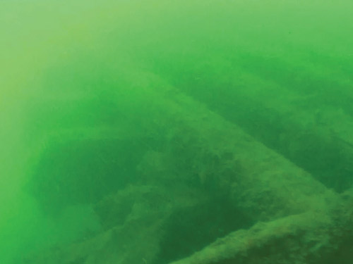
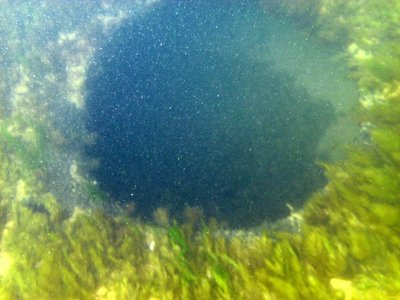
Media Click to enlarge |
|
| Wreck Photos/Drawings | 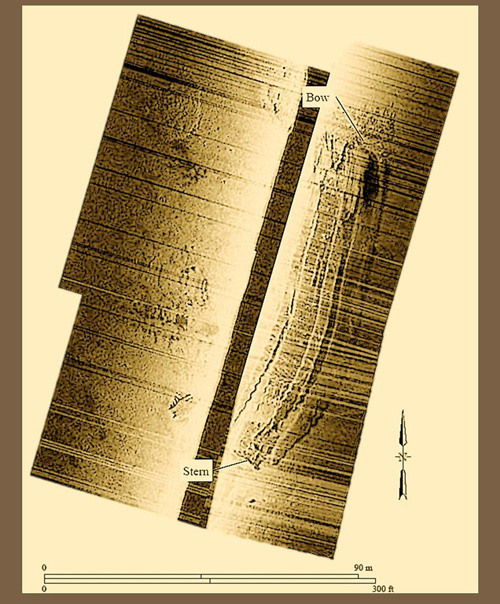 |
| Other Info | Virtual Tour |
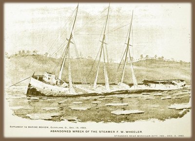
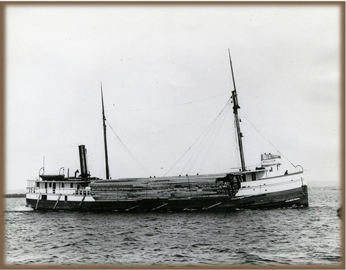
The F.W. Wheeler
| Shipwreck Identifying Factor | Description |
|---|---|
| Wreck Name | F.W. Wheeler |
| Vessel Type | Bulk Freighter |
| Date Built | 1887 |
| Where Built | West Bay City, MI |
| Size | The ship measured 265.5 feet in length by 40.5 feet abeam with a draft of 19.4 feet, and weighed 2300 gross tons. |
| Usage | Cargo transport, industrial materials such as coal |
| Date Sunk | * December 3, 1893 |
| Reason for Loss | Stranded during a winter storm |
| Depth of Wreck | 15 feet |
| Nearest City | Michigan City, Indiana |
| Details | It was carrying a cargo of 2,100 tons of coal from Buffalo on its way to Chicago. Local lifesaving crew rescued all 16 sailors in two trips, but ship was a total loss. |
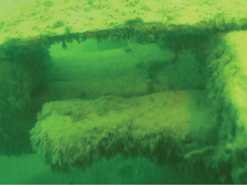
Media Click to enlarge | 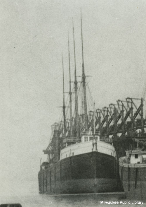 |
| Wreck Photos/Drawings |  |
The George F. Williams
| Shipwreck Identifying Factor | Description |
|---|---|
| Wreck Name | George F. Williams |
| Vessel Type | Bulk Freighter |
| Date Built | * July 24, 1889 |
| Where Built | West Bay City, Michigan |
| Size | The ship measured 280 feet in length by 41.4 feet abeam with a draft of 21.3 feet, and weighed 1888 gross tons. |
| Usage | Transport of commercial and industrial goods across Lake Michigan |
| Date Sunk | * April 21, 1915 |
| Reason for Loss | Abandoned and sunk |
| Depth of Wreck | 15 feet |
| Nearest City | Whiting, Indiana |
| Details | The vessel was abandoned in 1913 and was eventually towed offshore and sunk. |
Media Click to enlarge |
|
| Wreck Photos/Drawings | 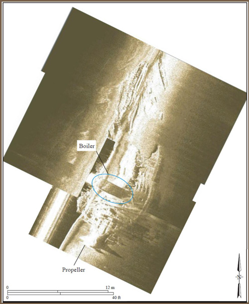 |

Horace A. Tuttle
| Shipwreck Identifying Factor | Description |
|---|---|
| Wreck Name | Horace A. Tuttle |
| Vessel Type | Bulk Freighter |
| Date Built | 1887 |
| Where Built | Unknown |
| Size | The ship measured 250 feet in length by 38.7 feet abeam with a draft of 20 feet, and the ship weight is currently unknown. |
| Usage | Transport of agricultural products such as corn |
| Date Sunk | * October 26, 1898 |
| Reason for Loss | Stranded during a severe storm in a storm. |
| Depth of Wreck | 24 feet |
| Nearest City | Michigan City, Indiana |
| Details | Following this shipwreck, rotten corn washed up on beach for many years. No lives were lost because all 14 crew members were rescued by the local lifesaving station. |
| Picture(s) | None |
| Wreck Photos/Drawings | 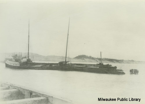 |
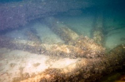
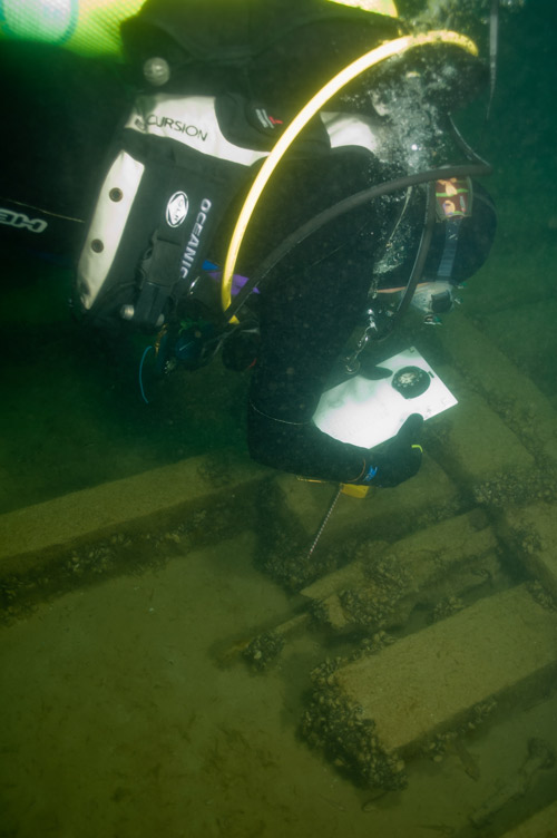
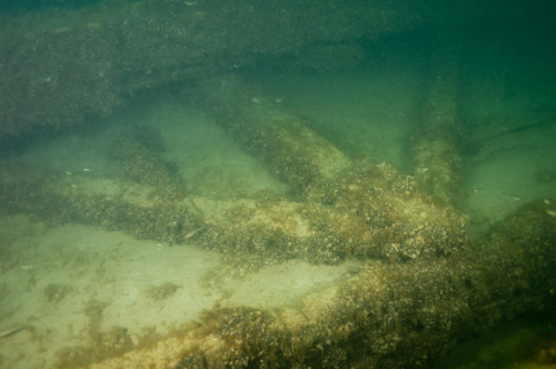
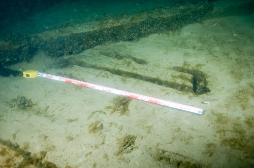
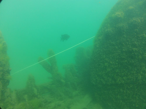
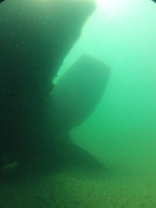
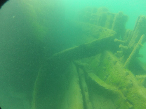
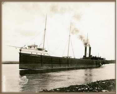
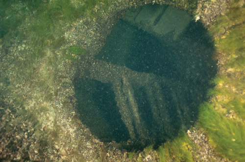
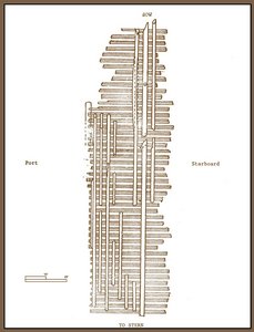
J.D. Marshall
| Shipwreck Identifying Factor | Description |
|---|---|
| Wreck Name | J.D. Marshall |
| Vessel Type | Cannaler |
| Date Built | 1891 |
| Where Built | South Haven, MI |
| Size | The ship measured 154.5 feet in length by 33.5 feet abeam with a draft of 12 feet, and weighed 531 gross tons. |
| Usage | Transport of commercial and industrial goods, such as lumber. Later, the vessel was converted to a sand-sucker or sand barge. |
| Date Sunk | * June 11, 1911 |
| Reason for Loss | Capsized in a storm. |
| Depth of Wreck | 29 feet |
| Nearest City | Indiana Dunes State Park, Indiana |
| Details | Four lives were lost when the vessel sunk. After capsizing, the vessel floated close to shore for several days before sinking. The company that owned the Muskegon used the insurance money from that loss to buy the J. D. Marshall. |
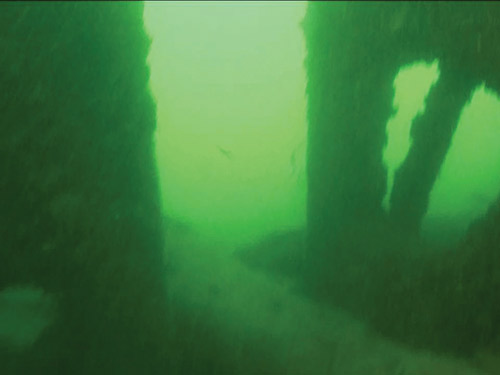
Media Click to enlarge |   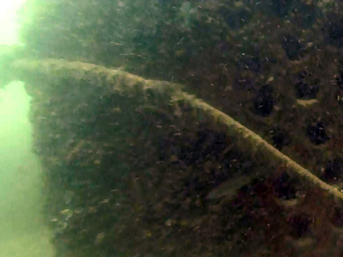  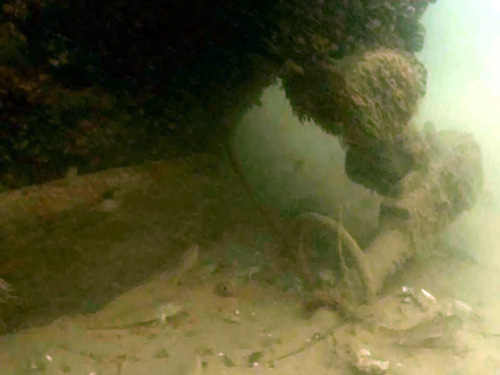  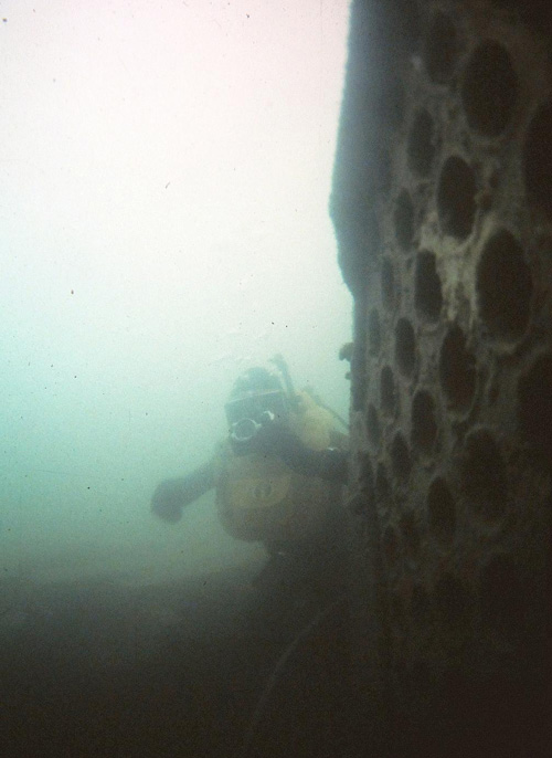 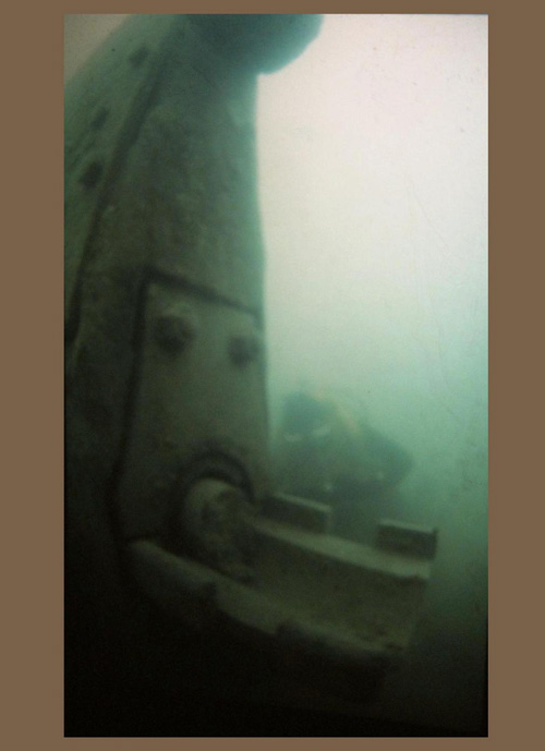 |
| Wreck Photos/Drawings | 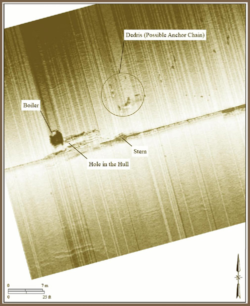 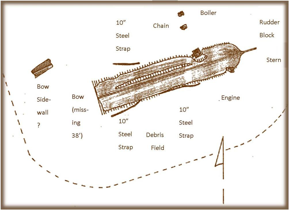 |
| Other Info | Dive Video | Virtual Tour | Nature Preserve |
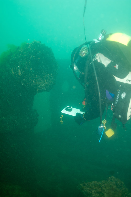
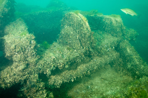
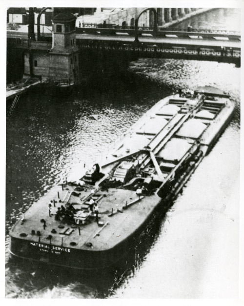
The Material Service Barge
| Shipwreck Identifying Factor | Description |
|---|---|
| Wreck Name | Material Service |
| Vessel Type | Self-unloading barge |
| Date Built | 1929 by Leatham D. Smith for the Smith-Putnam Navigation Company |
| Where Built | Sturgeon Bay, WI |
| Size | The ship measured 239.7 feet in length by 40.1 feet abeam with a draft of 13.9 feet, and weighed 1077 gross tons, or 736 net tons |
| Usage | Built specifically to transport sand and gravel from Lake Michigan to docks up the Chicago River |
| Date Sunk | 1936 |
| Reason for Loss | Foundered during a storm |
| Depth of Wreck | 35 feet |
| Nearest City | South Chicago, Illinois |
| Details | On the fateful last journey, the ship departed Lockport, Illinois, headed for South Chicago. Captain Charlie D. Brown commanded the vessel; he did not survive. Reportedly, a large wave washed over the ship, causing it to list sharply, before much of the crew could react and get free of their bunks. At the time of the disaster, the ship had a cargo of 2,500 tons of sand or gravel. It was owned by Material Service Company of Chicago; their loss was estimated at $500,000 in 1936. |
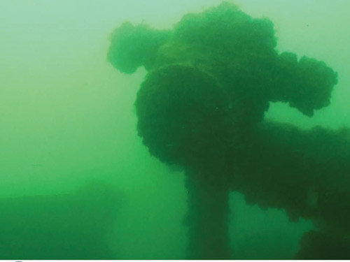
Media Click to enlarge |
|
| Wreck Photos/Drawings | 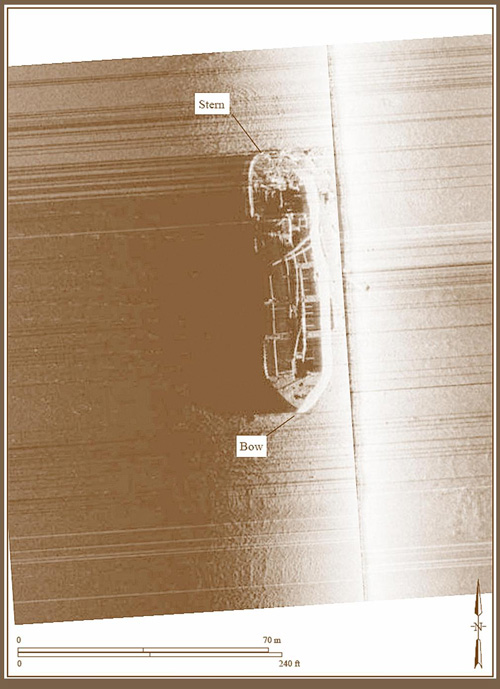  |
| Other Info | Dive Video | Virtual Tour |
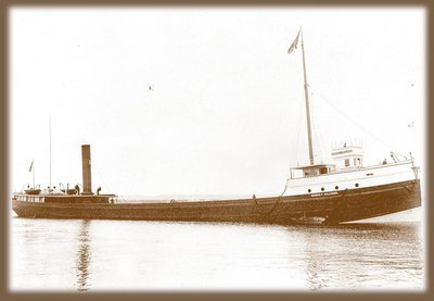
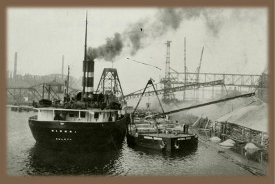
The Muskegon
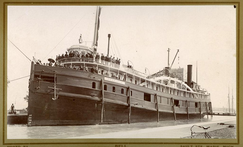
| Shipwreck Identifying Factor | Description |
|---|---|
| Wreck Name |
The Muskegon (also known as the Peerless) |
| Vessel Type | Package Freighter |
| Date Built | 1872 |
| Where Built | Unknown |
| Size | The ship measured 211 feet in length by 39.9 feet abeam with a draft of 12.5 feet, and weighed 1199 gross tons. |
| Usage | First as a passenger-steamer ship called the Peerless and then as a transport for commercial goods. |
| Date Sunk | * October 6, 1910 |
| Reason for Loss | Burned while at dock and then was towed out into lake Michigan where it was abandoned. |
| Depth of Wreck | 32 feet |
| Nearest City | Michigan City, Indiana |
| Details | The vessel ran between Chicago and Duluth when it was a passenger ship. In 1908, the vessel was renamed the Muskegon and converted to a bulk freighter. Sometime later it was re-converted to a sandsucker. No lives were lost when the ship burned. |
Media Click to enlarge |
|
| Wreck Photos/Drawings | 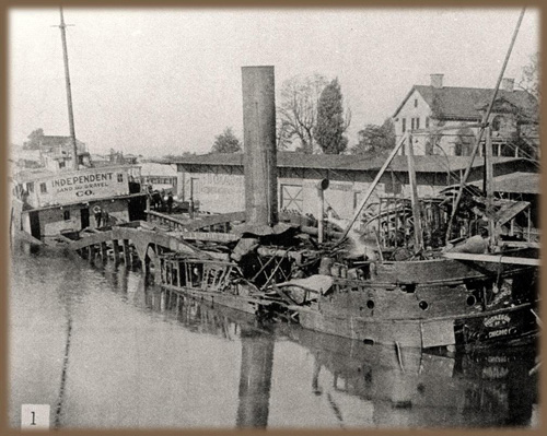  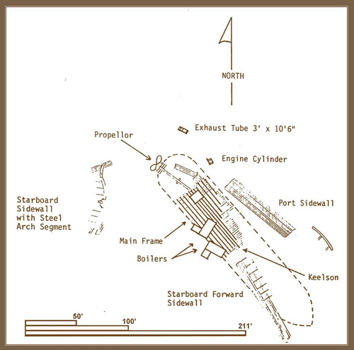  |
| Other Info | Dive Video | Virtual Tour |


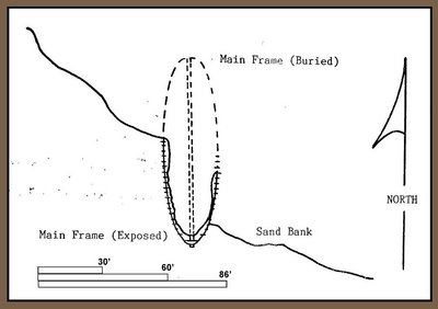
Unknown No. 3
| Shipwreck Identifying Factor | Description |
|---|---|
| Wreck Name | Unknown No. 3 |
| Vessel Type | Canaller |
| Date Built | Unknown, circa 19th to 20th century |
| Where Built | unknown at this time |
| Size | Remaining portion of the main frame measured 83.4 feet in length by 34.6 feet abeam. It was estimated that this vessel would have been 160 to 200 feet long. |
| Usage | Likely, bulk cargo, such as lumber |
| Date Sunk | Unknown |
| Reason for Loss | Unknown |
| Depth of Wreck | Shoreline, possibly buried as of 2011. |
| Nearest City | Pines, Indiana |
| Details | Only a portion of the main frame was identified in the 1980s |
Media Click to enlarge |   |
| Wreck Photos/Drawings | 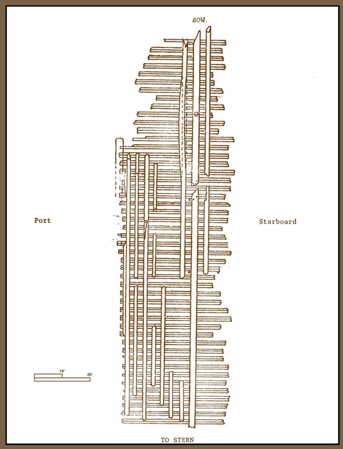 |
Unknown No. 4
| Shipwreck Identifying Factor | Description |
|---|---|
| Wreck Name | Unknown No.4 |
| Vessel Type |
Vessel is a small wooden vessel, possibly a schooner or a canaller |
| Date Built | Unknown, circa 19th to 20th century |
| Where Built | Unknown |
| Size | The remaining portion of the main frame measured 86 feet long by 18 to 20 feet abeam with a draft of 6 feet and an estimated weight of 2 gross tons |
| Usage | Commercial or industrial transport |
| Date Sunk | Unknown |
| Reason for Loss | Unknown |
| Depth of Wreck | Shoreline to 5 feet deep |
| Nearest City | Portage, Indiana |
| Details | Referred to as the "Alpha" wreck in the 1990s |
| Picture(s) | None |
| Wreck Photos/Drawings | 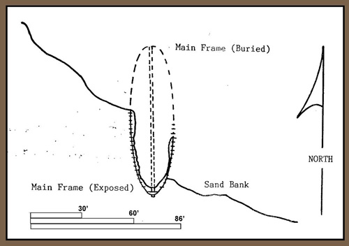  |
Unknown No. 5

| Shipwreck Identifying Factor | Description |
|---|---|
| Wreck Name | Unknown No. 5 |
| Vessel Type | Work Barge |
| Date Built | Unknown, circa 19th to 20th century |
| Where Built | Unknown |
| Size | |
| Usage | commercial or industrial transport |
| Date Sunk | Unknown |
| Reason for Loss | Unknown |
| Depth of Wreck | 4 feet |
| Nearest City | Gary, Indiana |
| Details | Incorporated with wreck Unknown No. 6 as one archaeological site. The vessel consists of three main structural parts and a large debris field. |
Media Click to enlarge | 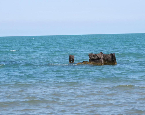  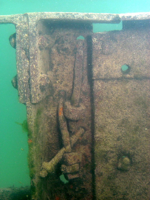 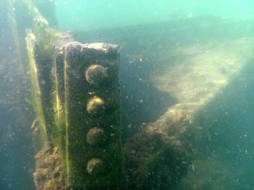 |
| Wreck Photos/Drawings | None |
Unknown No. 6
| Shipwreck Identifying Factor | Description |
|---|---|
| Wreck Name | Unknown No. 6 |
| Vessel Type | Work Barge |
| Date Built | Unknown, circa 19th to 20th century |
| Where Built | Unknown |
| Size | Unknown |
| Usage | Commercial or industrial transport |
| Date Sunk | Unknown |
| Reason for Loss | Unknown |
| Depth of Wreck | 10 feet |
| Nearest City | Gary, Indiana |
| Details | Incorporated with wreck Unknown No. 5 as one archaeological site |
Media Click to enlarge | 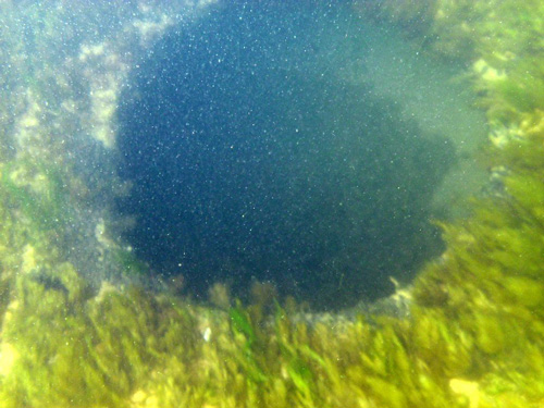  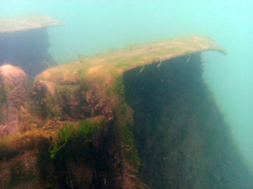 |
| Wreck Photos/Drawings | None |
Unknown No. 7
| Shipwreck Identifying Factor | Description |
|---|---|
| Wreck Name | Unknown No. 7 |
| Vessel Type | Suggested bulk cargo wooden canaller |
| Date Built | Unknown, circa 19th to 20th century |
| Where Built | Unknown |
| Size | Existing section of the bow measured 40 feet |
| Usage | Unknown |
| Date Sunk | Unknown |
| Reason for Loss | Unknown |
| Depth of Wreck | 3 feet |
| Nearest City | Pines, Indiana |
| Details | Unknown |
| Picture(s) | None |
| Wreck Photos/Drawings | None |
Unknown No. 8
| Shipwreck Identifying Factor | Description |
|---|---|
| Wreck Name | Unknown No. 8 |
| Vessel Type | Suggested bulk cargo wooden canaller |
| Date Built | unknown at this time (19th to 20th century) |
| Where Built | Unknown |
| Size | Section of the bow measured 13 feet long, suggested to have measured at least 100 ft |
| Usage | Unknown |
| Date Sunk | Unknown |
| Reason for Loss | Unknown |
| Depth of Wreck | 3 feet |
| Nearest City | Furnessville, Indiana |
| Details | Unknown |
| Picture(s) | None |
| Wreck Photos/Drawings | None |
Unknown No. 9
| Shipwreck Identifying Factor | Description |
|---|---|
| Wreck Name | Unknown No. 9 |
| Vessel Type | Suggested bulk cargo wooden canaller |
| Date Built | Unknown, circa 19th to 20th century |
| Where Built | Unknown |
| Size | Section of the bow measured 13 feet long, suggested to have measured at least 100 ft |
| Usage | Unknown |
| Date Sunk | Unknown |
| Reason for Loss | Unknown |
| Depth of Wreck | 3 feet |
| Nearest City | Furnessville, Indiana |
| Details | Unknown |
| Picture(s) | None |
| Wreck Photos/Drawings | None |
Photos are property of Indiana DNR, unless otherwise noted, and not to be used without permission. Please review the DNR photo use policy if you would like to use the photos.