Language Translation
  Close Menu

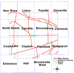
The Division of Water has completed several maps to assess the ground-water resources of Hendricks County. To view the countywide maps click on the type of assessment map below.

In addition, maps of the bedrock surface and thickness of unconsolidated deposits have been completed. For more details refer to the general description of the metadata and disclaimer statement.

Click the county or quad name within the maps below.

Mooresville West quad bedrock surfaceHall quad bedrock surfaceEminence quad bedrock surfaceBridgeport quad bedrock surfacePlainfield  quad bedrock surfaceClayton quad bedrock surfaceCoatesville quad bedrock surfaceClermont quad bedrock surfaceBrownsburg quad bedrock surfaceDanville quad bedrock surfaceNorth Salem quad bedrock surfaceZionsville quad bedrock surfaceFayette quad bedrock surfaceLizton quad bedrock surfaceNew Ross quad bedrock surfaceZionsville quad Unconsolidated ThicknessFayette quad Unconsolidated ThicknessLizton quad Unconsolidated ThicknessNew Ross quad Unconsolidated ThicknessMooresville West quad unconsolidated thicknessHall quad unconsolidated thicknessEminence quad unconsolidated thicknessBridgeport quad unconsolidated thicknessPlainfield quad unconsolidated thicknessClayton quad unconsolidated thicknessCoatesville quad unconsolidated thicknessClermont quad unconsolidated thicknessBrownsburg quad unconsolidated thicknessDanville quad unconsolidated thicknessNorth Salem quad unconsolidated thickness

 News

View More News

 Top FAQs