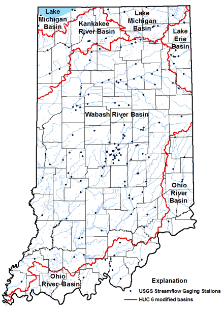
This series, created to provide e-products (such as GIS coverages) for quick release includes:
- Maps and digital coverage of baseflow basin boundaries
- Text describing baseflow
- Spreadsheet of baseflow calculations for two methods showing monthly and annual results
- GIS shapefiles of pertinent geographic and
hydrologic features displayed on the maps - Images, additional text, tables, and shapefiles
are available for free download - Baseflow Mapping Overview
Click on the basins below to view baseflow maps.
- Coming soon!
