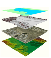
The GIS community is governed by Indiana state statute that assigns responsibilities and duties to the Indiana Geographic Information Office (GIO).
IC 4-23-7.3 (7/1/2007)
The state GIS Officer shall do the following:
- Facilitate GIS data cooperation between units of the federal, state, and local governments.
- Integrate GIS data and framework data developed and maintained by state agencies and political subdivisions into the statewide base map.
- Develop and maintain statewide framework data layers associated with a statewide base map or electronic map.
- Except as otherwise provided in this chapter, provide public access to GIS data and framework data in locations throughout Indiana.
- Serve as Geographic Information Officer for state agencies.
The GIS Office contributes to the quality of Indiana as a place to live and work by cultivating statewide geographic information resources (relationships, data and technology) so that individuals and organizations across the state have suitable access to accurate and relevant geographic information and technology.
Indiana government GIS data are public records and are not subject to licensing or royalties per an opinion of Indiana's Public Access Counsel.

