Map of Indiana Canals 1805-1915
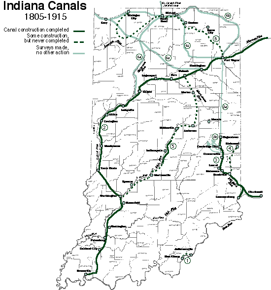
1 Ohio Falls Canal--to provide passage around the Falls of the Ohio, 1805, 1816.
2 Wabash and Erie Canal--to connect Lake Erie with the Ohio River through the Wabash Valley, 1827.
3 Whitewater Canal--to connect Whitewater Valley with the Ohio River, 1833, 1836.
3a , 3b . Surveys, 1825, 1837 of proposed routes for Whitewater Canal.
4 Richmond and Brookville Canal--to connect Richmond to Whitewater Canal, 1837.
5 Central Canal--to connect Wabash River with Ohio River at Evansville, 1836.
6 Erie and Michigan Canal--linking Wabash and Erie Canal with Lake Michigan, 1836.
6a - 6d . Surveys completed to link Lake Michigan and Wabash Valley, 1829, 1830, 1876, 1915.