Location
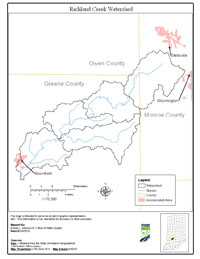
The Richland Creek Watershed is located in southwestern Indiana, draining approximately 105 square miles in Greene, Monroe and Owen counties. Major streams included in the Total Maximum Daily Load (TMDL) report are Richland Creek, Little Richland Creek, Beech Creek, Ore Branch, Dry Branch and Blakeman Hollow.
History
A comprehensive survey of the Richland Creek Watershed was conducted by Indiana Department of Environmental Management (IDEM) from September 11, 2001 to October 9, 2001. The primary cause of impairment is Escherichia coli bacteria (E. coli). Pollution sources in the watershed include nonpoint sources from agriculture and pastures, land application of manure and urban and rural run-off, as well as point sources from straight pipe discharges, home sewage treatment system disposal and combined sewer overflow outlets.
Pollutants Addressed
TMDLs for the Richland Creek watershed are established for E. coli and will address eight impairments. Some of the recommended solutions to address the impairments include storm water controls, point source controls, manure management and habitat improvements.
Timeline
A kickoff TMDL meeting was held on November 1, 2005 at 498 Lincoln Drive, Bloomfield, Indiana starting at 6:00 p.m.
A draft TMDL meeting was held on March 15, 2006 at the Bloomfield-Eastern Green County Public Library, 125 South Franklin St., Bloomfield, Indiana starting at 6:00 p.m.
The 30-day public comment period for the draft Richland Creek Watershed TMDL began on March 15, 2006 and ended on April 17, 2006.
U.S. EPA under Section 303(d) of the Clean Water Act approved the Richland Creek Watershed TMDL report on August 3, 2006 for eight impairments. TMDL reports identify and evaluate water quality problems in impaired water bodies and propose solutions to bring those waters into attainment with water quality standards.