Indiana 2025 Orthoimagery Roadshows
Bringing High Resolution Imagery to Your Community
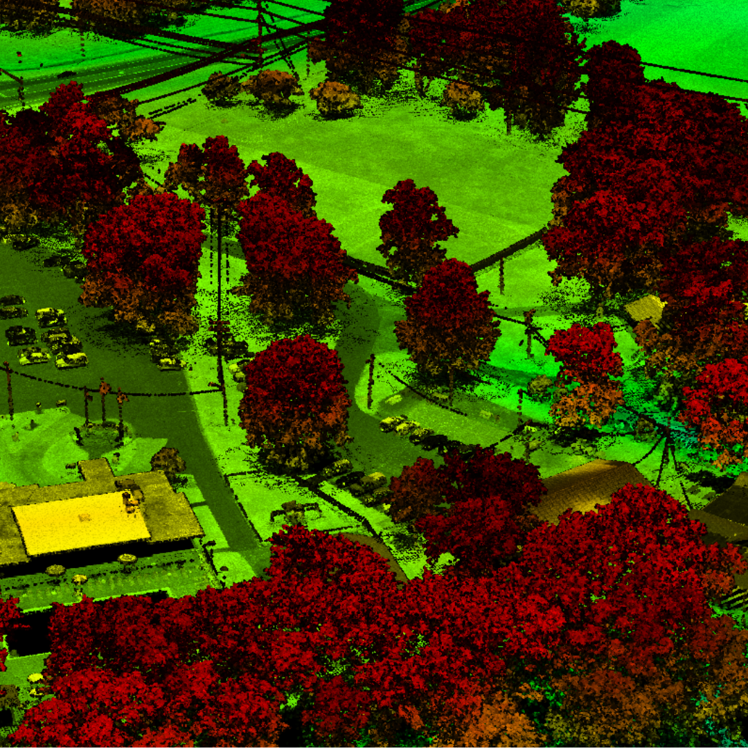
The IGIO has engaged in orthoimagery collection since 2005, creating a statewide source of authoritative, accurate, and readily available imagery. For the 2025 - 2028 imagery cycle, Woolpert has been selected to provide Imagery and Lidar for the State. This program's base specification is 3-inch, 4-band ortho imagery, and Lidar QL1 at 25ppsm.
Additional geospatial data may be purchased using the state's procurement process, eliminating the need for internal RFPs, contract management, QA/QC, and public access storage, making it easier for all levels of government to access these valuable resources.
Orthoimagery is high resolution aerial photography that is geometrically corrected for accuracy. Making imagery available on a statewide level allows for a multitude of use cases, including but not limited to:
- Emergency response and disaster management.
- Infrastructure planning and development.
- Environmental monitoring (tracking and visualizing changes in land features over time)
- Land use planning.
- Public safety, transportation, and utilities.
Indiana takes pride in making orthoimagery openly available at a statewide level to anyone, whether it be the public or private sector. Providing imagery on this level saves valuable time and money for all those who utilize orthoimagery in their work, research, or decision-making processes.
Orthoimagery Roadshows
Each year, the IGIO hosts in-person "roadshows" across Indiana to share information about the latest orthoimagery updates. These roadshows aim to answer questions, gather feedback, inform attendees on how to access the data, and engage with local stakeholders. The focus of this year's roadshows will be the 2026 imagery collection cycle, which encompasses the eastern portion of the state.
The IGIO encourages participants in the eastern tier of Indiana to attend one of our 3 upcoming roadshows to learn more about this year's cycle. Local government officials, GIS professionals, planners, emergency managers and anyone else interested in utilizing ortho imagery is invited to attend!
This year's roadshows will emphasize our other imagery-related products that are available, including contours and building outlines.
How Do I Attend?
The IGIO will host 3 road shows for the 2026 cycle in eastern Indiana. Lunch will be generously provided by our imagery partner, Woolpert.
Please fill out the registration form: Roadshow Registration
- March 18th, 11am to 1pm
- Whitley County Government Center, 220 W Van Buren St, Columbia City, IN 46725
- March 19th, 11am to 1pm
- Hunter Hall, 400 W Vaughn Dr, Madison, IN 47250
- March 20th, 11am to 1pm
- Wayne County Government Center, 401 E Main St, Richmond, IN 47374
Who Will Be Attending the Roadshows?
- Brian Stevens - VP, Program Director, Woolpert
- Matt Worthy - Project Manager, Woolpert
- Shaun Scholer - GIS Program Director, IGIO
- sscholer@iot.in.gov
- Daniel Council - Geographic Information Outreach Coordinator, IGIO
- dcouncil@iot.in.gov
- Richard Rahe - Geographic Information Outreach Coordinator, IGIO
- rrahe@iot.in.gov
Attendees and anyone interested in our imagery program may contact our Outreach Coordinators or speakers for follow-up questions, imagery resources, and any other comments or concerns.
See you on the road!
Additional Resources
- Imagery Program
- Elevation Program
- IndianaMap - Imagery Data