- Clifty Falls State Park Alerts (3)
- SOUTH ENTRANCE CLOSED FEB. 16 - MAY 1, 2026: Due to INDOT repair work on the historic bridge over Little Crooked Creek on Canyon Road, the South Entrance to the park will be closed. Guests may use the North Entrance off State Road 62 to access the park. We apologize for the inconvenience.
- TRAFFIC ALERT: There is a temporary one-lane traffic pattern at the south entrance of Clifty Falls State Park and the 1200 block of W. Main Street. Temporary signals will manage traffic at each end of the closure. The project started Aug. 25 and is expected to last about six weeks, but signals will be removed sooner if not needed. Thank you for your patience.
- Brough’s Tunnel Closed: Due to an early spring rockslide and the possibility of additional large rocks falling near the entrance, the tunnel is closed for an indefinite period of time. The park is evaluating how to mitigate any future rockslides, with the intention of opening the tunnel in the future. Trail 5 remains open, but please avoid both tunnel entrances.
- Description
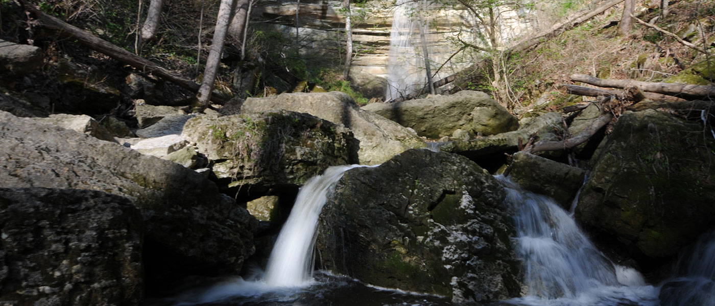
Clifty Falls State Park is located near Madison with entrances on state roads 56 and 62. The park’s waterfalls change moods with the weather and the seasons and can range from roaring plunges to delicate bridal-veil mists to gleaming frozen titans. Winter and spring visits reveal them at their best. The rugged splendor of Clifty Canyon offers exciting year-round hiking and scenery.
Clifty Creek’s stony bed is littered with fossil remnants telling of a long-vanished marine ecosystem that teemed with life that included ancient corals, ancestral squids, brachiopods, and more. Fossil collecting within Clifty Falls State Park is prohibited but nearby collecting locations are readily accessible.
In Historic Madison, tour the Lanier State Historic Site, the former mansion of frontier banker James F.D. Lanier, and enjoy the drive along the beautiful Ohio River. Plan a park visit during one of the community's special events, such as the July Regatta hydroplane boat race or the Madison Chautauqua Festival of Art in late September.
Please note: Brough’s Tunnel is closed for an indefinite period of time due to an early spring rockslide and the possibility of more large rocks falling near the entrance. The park is evaluating how to mitigate any future rockslides, with the intention of opening the tunnel in the future. Guests can enjoy the many other features of Clifty Falls State Park while creating memorable experiences safely.
During the summer, pool hours may change because of weather and staffing. Please contact the property office for exact times before your visit. - Activities
- Nature Center/Interpretive Naturalist Services
- Shelters (Shelter Reservations)
- Picnicking
- Hiking Trails
- StoryWalk ®
- Four Falls Hiking Challenge
- Tennis & Other Games
- Meeting & Conference Facilities
- Clifty Falls Centennial Challenge
- Clifty Inn and Restaurant
- Swimming Pool / Waterslide (Policy) Check office for hours.
- ADA Waterfall Overlook
- ADA Colorblind viewers
Camping - See campground maps under MAPS tab
- Electric / 106 sites
- Non-electric / 63 sites
- Youth Tent Areas
- Dumping Station
INFORMATION
- Trails
Note: For trail locations, view the property map under the MAPS tab.
The Friends of Clifty Falls State Park and Jefferson County Library partnered to create a StoryWalk® on the paved walking loop that begins at the trailhead of Trail 7 near Clifty Shelter. This trail is easy and wheelchair accessible. Read a book while going for a short, easy walk! After completing the StoryWalk® you are welcome to pick up a sticker at the nature center.
1.*RUGGED (.75 mile)—Starts at nature center parking lot, proceeds to Observation Tower overlooking Ohio River, then along canyon wall to park road. Long, steep grades in and out of canyon.
2. VERY RUGGED (3 miles)—One-way, no-outlet in North End. Continual water damage and rockslides have required the removal of this structure for everyone’s safety; therefore, access in and out of the canyon is available only via connecting trails 1, 4, 5, and 8. Trail 2 is primarily the stone bed of Clifty Creek and may be impassable during times of high water. Areas above and below all waterfalls are always OFF LIMITS.
3.*RUGGED (1 mile)—Starts at park road just south of Poplar Grove. Long grade descends to midcanyon, then follows along canyon. Steep grades rise to Poplar Grove. Easy walking to near side of Beech Grove connecting with Trail 4.
4.*RUGGED (.75 mile)—Starts at Hoffman Falls parking lot. Short distance to spectacular falls overlook. Follows canyon to Lilly Memorial (spur connects to Clifty Creek), which has a long, steep staircase at Lilly Memorial.
5.*RUGGED (.875 mile)—Starts at Lilly Memorial, long, steep staircase to mid-canyon. Follows along canyon past tunnel entrances (spur connects to Clifty Creek), past Oak Grove to Tunnel Falls. Steep staircase from falls overlook to road.
6. MODERATELY RUGGED (.5 mile)—Starts at Hickory Grove, follows canyon just below rim to Lookout Point. Some very rocky footing.
7. MODERATELY RUGGED (1.25 miles)—Starts at Clifty shelter, proceeds past Little Clifty Falls along rocky footing to Lookout Point. Returns to picnic area east of shelter via upper Little Clifty Creek gorge.
8. RUGGED (4.5 miles)—Starts just west of north gatehouse. Proceeds south along west rim of Clifty Canyon. Steep grades to Clifty Creek at north and south ends of trail. (Steep switchback connects to creek across from Oak Grove.) Exits south canyon to park road or Trail 1 to nature center.
9. MODERATE (1 mile)—Campground to nature center and Clifty Inn, via swimming pool.
10.EASY (.75 mile)—Starts at back of swimming pool parking lot, features old field ecology.
*Brough’s Folly 1852 railroad path
- Maps
- Photos & Video
Loading events


