Summary
In response to interest from local landowners and conservation partners, the Jefferson County Soil and Water Conservation District (SWCD) applied for and was awarded an EPA Clean Water Act 205j grant from the Indiana Department of Environmental Management (IDEM) to develop a watershed management plan (WMP) for the Indian-Kentuck watershed. In June 2012, Jefferson County SWCD contracted with Historic Hoosier Hills RC&D to conduct field work, outreach, and develop the watershed management plan.
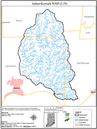
Indian-Kentuck watershed is a 10-digit Hydrologic Unit Code (HUC) watershed (0514010102) comprised of 97,822 acres, located in Jefferson, Ripley, and Switzerland Counties, Indiana. Forest dominates the watershed landscape comprising 65% of the area. Other major land uses include cultivated cropland (15%) and pasture and hay (11%). Unincorporated towns within the watershed include Benham, Brooksburg, Bryantsburg Canaan, China, Cross Plains, and Manville. Based on water quality sampling conducted by IDEM and the watershed inventories conducted during the Indian-Kentuck watershed project, E. coli, nutrients, and sediment were identified as water quality problems in the watershed.
The WMP is a strategy for achieving water quality goals by characterizing the watershed, setting goals and actions steps, and developing an implementation plan to address documented problems. The Indian-Kentuck WMP meets the requirements of IDEM’s 2009 Watershed Management Plan Checklist and was approved by IDEM in August 2014.

