Summary
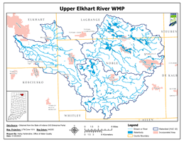
Kosciusko County Soil and Water Conservation District (SWCD) received a 205j grant in 2015 from the Indiana Department of Environmental Management (IDEM) to write a Watershed Management Plan (WMP) for the Upper Middle Eel River watershed. The Upper Middle Eel River Watershed consists of two sub-watersheds of the Eel River Watershed, 10-digit HUC 0512010404 (Clear Creek-Eel River) and 10-digit HUC 0512010403 (Sugar Creek-Eel River) in the Wabash, Whitley, Kosciusko, and Huntington counties. The Upper Middle Eel River Watershed is comprised of 26.25 river miles from Columbia City to North Manchester, Indiana and drains a land area of 163,034 acres. Current land use in the Upper Middle Eel River Watershed is predominantly cultivated crops (~79%), with only small acreage of residential and forested areas.
The major water quality problems observed throughout the watershed were from nitrogen, phosphorus, E. coli, sediment and turbidity. Samples collected by Manchester University showed that Nitrate-Nitrogen exceeded the target of 2.2 mg/L in 96% (1843/1920) of the samples collected. Total Phosphorus exceeded the target value of 0.076 mg/L in 99.6% (1905/1913) of the samples. E. Coli exceed the target value of 235 cfu/100mL in 74% (251/339) of the samples. Total Suspended Solids exceed the target value of 30 mg/L in 72% (1368/1902) of the samples. The goal is to have water samples meet the targeted concentration levels established in the WMP by 2050. The overall project progress will be tracked using the action register as a guide for the schedule of activities to be completed throughout the future. The Upper Middle Eel WMP was approved by IDEM and US Environmental Protection Agency in January 2024.

