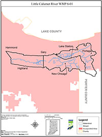
Little Calumet River WMP 6-01
Summary
The Little Calumet River Watershed covered by this plan includes three 14-Digit HUC watersheds. Specific waterways included in these areas are the east reach of the western branch of the Little Calumet River, the Willow Creek watershed, and a portion of the Deep River watershed. This study was funded by a Section 319 Grant through the Indiana Department of Environmental Management (IDEM) with matching funds provided by the local sponsor, the Gary Storm Water Management District.
The watersheds covered by this plan are located in Northwest Indiana and are highly urbanized though some agriculture does still occur. A flood control project by the Army Corp of Engineers (ACOE) is currently underway on this portion of the Little Calumet River.
The Little Calumet River Watershed Management Plan has been developed over the course of 15 months by the Steering Committee and its consultants. Nine steering committee meetings have been held with two of them advertised to the public for public input. The overall process closely followed the Indiana Watershed Planning Guide.
All of the communities within the watersheds were invited to participate prior to the beginning of the project. Once the project began they were again encouraged to attend the steering committee meetings. The Steering Committee developed the Mission Statement for this watershed management plan and began identifying issues and concerns within the watersheds. A public meeting was conducted at Indiana University Northwest to give the public an opportunity to add to that list of identified issues and concerns.
Information was compiled from a wide variety of sources including but not limited to previous studies in this area, on going projects including the Army Corp of Engineers Flood Control and Recreation Project, the approved Total Maximum Daily Load (TMDL) for the Little Calumet River, municipal Geographic Information Systems (GIS) and sewer atlases, a limited sampling program, a stream reach survey, and numerous publicly available databases with information such as topography, land usage, aerial photographs, etc. The Steering Committee then compiled a series of problem statement from the list of issues and concerns from each source. These problem statements were then used to set goals for this plan to improve upon those issues. The goals identified as part of this plan include:
- Goal 1: Reduce E. coli levels in the Little Calumet River by reducing loads to the River to meet beneficial uses.
- Goal 2: Reduce sediment loads by source reduction strategies and, in priority subwatersheds, through the use of Best Management Practices (BMPs).
- Goal 3: Reduce nutrient loads by source reduction strategies and, in priority subwatersheds, through the use of BMPs.
- Goal 4: Restore, improve, and/or protect floodplains, wetlands, natural areas, and riparian corridors.
- Goal 5: Improve public awareness/knowledge of pollutant loads, sources, and solutions, especially with regard to E. coli, and the impacts and risks associated with them.
- Goal 6: Create an active watershed alliance or conservancy district that facilitates and implements information sharing including ordinances, projects/experiences, and educational materials in a central location.
- Goal 7: Increase river corridor connectivity, river navigability, and public access sites and make the public aware of them.
Specific milestones toward each goal have been set with an indicator designated to measure progress toward completion of each goal. Critical areas have been identified within the watershed where efforts will be focused to have the greatest impact on water quality.
Findings from this watershed planning process include:
- The flow control structure being built as part of the Little Calumet River Flood Control and Recreation Project will divert high flows that currently flow west toward Illinois from Hart Ditch east into this watershed. When this occurs, higher flows with larger pollutant loads will flow through the watersheds covered by this plan.
- Base flow levels of E. coli bacteria were not as high as they could have been and appear to be manageable. Application of the plan will bring the River into compliance with water quality standards for E. coli during base flows. High flows will continue to be a problem until combined sewer overflows are eliminated and flows from Hart Ditch are not elevating bacteria counts within this watershed.
- Other pollutants in the watersheds including Total Suspended Solids (TSS), nitrogen, and phosphorus are at levels that can adversely impact biological communities.
- An active watershed alliance or conservancy district is needed to bridge existing political boundaries.
- Public access to and information about the River will need to be improved as the River is cleaned up and the public wants to utilize it.
- Natural areas along the river and its tributaries were plentiful, especially along Deep River.

